If all goes as planned, NASA's American Perseverance rover will land on Mars on February 18, 2021. During its descent phase, it will be guided autonomously to the safest possible landing site thanks to ultra-accurate maps.
Although NASA, to date, has still managed to land eight machines on Mars, the operation remains complicated. About half of the attempted landings on the red planet have indeed failed.
One of the reasons a soft landing is so difficult is that the spacecraft cannot be guided manually . Indeed, several tens of millions of km from the Earth, the slightest command from terrestrial operators then takes more than 12 minutes to reach the rover.
This is why, at least during the risky descent phase, the previous machines had to perform all the necessary maneuvers based on the instructions programmed in advance in their on-board computer.
Perseverance, for its part, will also have to manage its own landing on its own. On the other hand, it will have a certain advantage compared to the previous missions.
Before Perseverance, craft that successfully landed on the Red Planet had to rely on maps drawn from low-resolution imagery, covering large areas of elliptical landing.
For its part, the Mars 2020 mission will benefit from a new navigation system (TRN) to guide its descent. It is also he who will change course autonomously if necessary.
The mission will also benefit from new maps produced by the United States Geological Survey (USGS), based on high-resolution images captured by NASA's Mars Reconnaissance Orbiter.
The first card offers a 25 centimeters per pixel resolution . It will identify potential hazards at the landing site. The second is a more "traditional" surface structure map, with a resolution of approximately six meters per pixel .
During the descent, a camera will take pictures of the Martian landscape. The onboard TRN system will then compare these images to the two precisely aligned maps. If the navigation system spots a potential obstacle, retro flares will then be activated to shift the landing to a safer area.
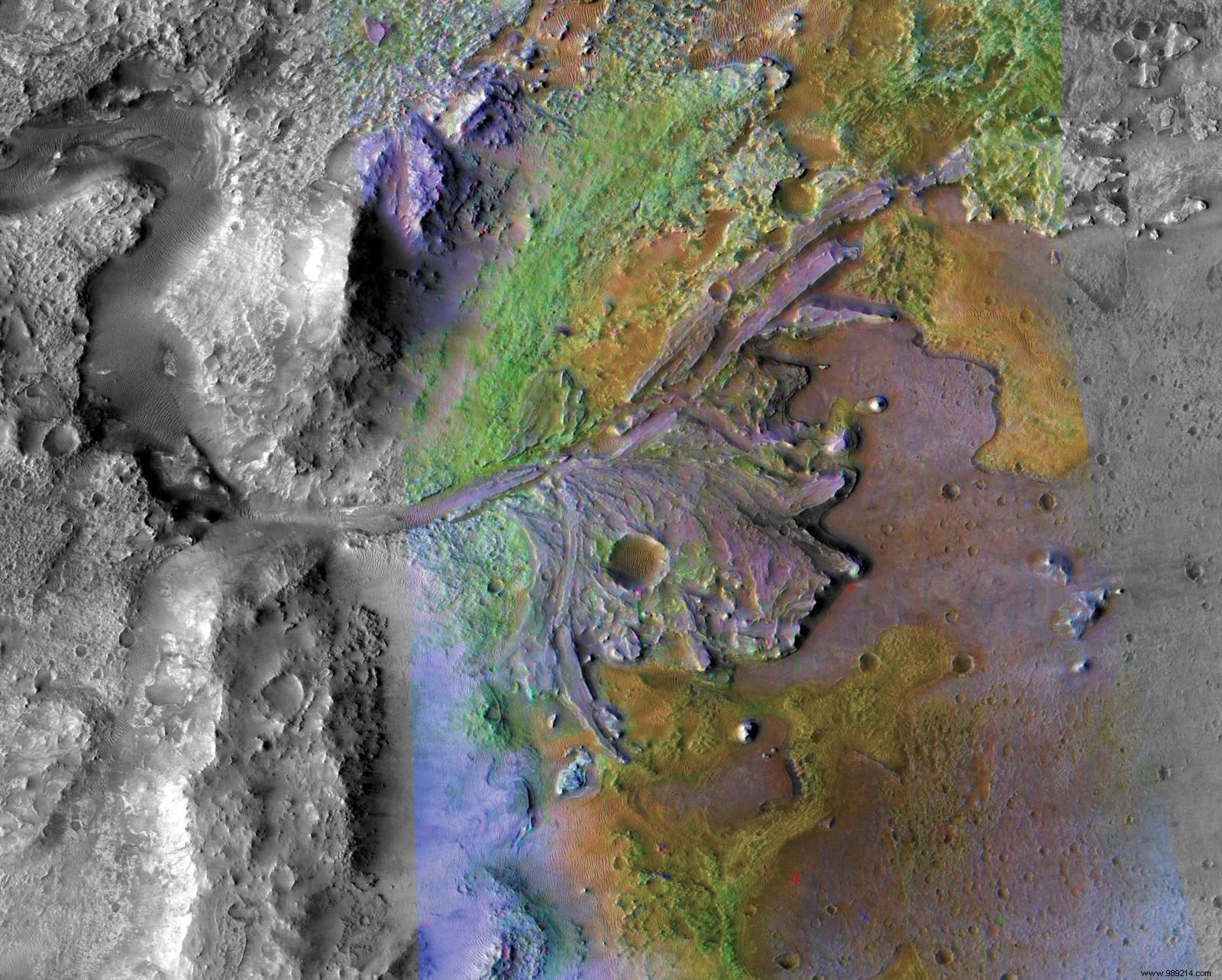
These new technologies will be of great help to this mission. As a reminder, Mars 2020 is due to land in Jezero Crater (above), a 45 kilometer wide formation that once housed a lake and a delta of rivers.
The site, a priori, seems ideal to serve the main objective of the mission, namely to search for traces of past life. On the other hand, on site, the terrain is particularly rugged , especially in the delta region which is of so much interest to researchers.
Hence the importance of negotiating the landing well. These maps, ultimately, will help researchers unravel the Red Planet's past mysteries.
Source